
Rhine to split into two non-navigable sections as water levels hit single digits

Story Timeline
2 months · 16 summary articles
The Rhine River may soon split into two non-navigable sections for commercial and passenger traffic as water levels at the critical Kaub gauge near Koblenz are forecast to drop to a single-digit reading this week, according to Jens Schwanen, managing director of the German Inland Waterways Association (BDB). Speaking to the *Rheinische Post*, Schwanen said the river would effectively be divided, with shipping possible only between the ARA ports of Amsterdam, Rotterdam, and Antwerp and Cologne via the western canal network, while southern routes along the Main, Moselle, Neckar, and Danube-Main Canal would remain open .
The BDB warned that freight and excursion vessels would be unable to operate on the central stretch, disrupting supply chains. Four German states—North Rhine-Westphalia, Lower Saxony, Rhineland-Palatinate, and Saarland—have already relaxed Sunday trucking bans to mitigate transport bottlenecks, the ADAC motorists’ association noted .
Low water levels have plagued German rivers for weeks, with the Rhine, Elbe, and Danube recording extreme lows. The German Transport Ministry plans crisis talks this week to explore shifting cargo to roads and rail, and to review construction work on transport networks .
Across Europe, drought and heatwaves are straining water resources. The Danube is at its lowest level since 1996, affecting agriculture, transport, and energy in Central and Eastern Europe, while 67 French departments face water restrictions. The EU’s 2025 Water Resilience Strategy aims to address systemic shortages, with 30% of Europeans and 20% of land already under annual water stress .
In Italy, 19 cities remain on red alert for heat, with drought increasing wildfire risks from Tuscany to Piedmont. Spain’s meteorological agency issued warnings for 10 regions, forecasting temperatures up to 40°C and severe thunderstorms in Valencia, the southeast, and Navarra . The Netherlands braces for a fifth heatwave, with temperatures expected to reach 35°C by Thursday .
German forests show severe stress, with four out of five trees affected by drought since 2018, according to a Technical University of Munich study published in *Nature Geoscience*. Researchers reported an unprecedented loss of biomass and carbon storage, with 94% of North Rhine-Westphalia’s land area experiencing unusual dryness by late July .
Follow us for live European news
- 5
- 2
- 2
- 2
- 1
- 1
- 1
- 1
- 1
- 1
- 1
- 1
- 1
3 further sources not geolocated
Articles

Niedrigwasser: Verband warnt: Rhein bald nicht mehr durchgängig befahrbar
die zeit · about 2 months ago
![Škrlatica[Skipping ahead some. -- ed.]Mike and Cameron were making a beeline for Venice, but having ridden up the Vrata Valley to do Triglav, it made sense to me to stay and do another peak. Škrlatica, on the other side of the valley, was fairly prominent and looked like it could be part of a loop with some neighboring peaks. It was forecast to be yet another hot day with a chance for afternoon showers, so I started aroun #Europe](https://files.mastodon.social/cache/media_attachments/files/117/069/713/895/844/079/original/cc292243989b6f35.jpeg)
Škrlatica[Skipping ahead some. -- ed.]Mike and Cameron were making a beeline for Venice, but having ridden up the Vrata Valley to do Triglav, it made sense to me to stay and do another peak. Škrlatica, on the other side of the valley, was fairly prominent and looked like it could be part of a loop with some neighboring peaks. It was forecast to be yet another hot day with a chance for afternoon showers, so I started aroun #Europe
mastodon bot · about 2 months ago
Heißer Sommer: Hitze-Warnung im Süden - Schulstart in ersten Bundesländern Der Wochenstart wird vor allem in der Südhälfte Deutschlands heiß. Sonnig ist es aber nicht überall.
tagesspiegel · about 2 months ago
Can the EU stop Europe from running out of water? Ask the Euronews AI chatbot Record temperatures are draining Europes water supply. With rivers at historic lows, drier soils, and severe water restrictions, concerns over the blocs water scarcity are growing. But what is the EUs plan? Ask the Euronews AI chatbot.
euronews · about 2 months ago

Weather Ireland: Temperatures may hit 28 degrees over coming days Monday mostly dry with mix of cloudy and sunny spells
irish times · about 2 months ago
Hitze und Trockenheit: Es bleibt heiß und trocken in NRW – Rheinpegel sehr niedrig
die zeit · about 2 months ago

A Decade After North Macedonias Deadliest Floods, Dangers Remain Ten years after a flash flood caused devastation near Skopje, BIRN found many of the conditions that turned an extreme weather event into a disaster remain in place.
balkaninsight · about 2 months ago
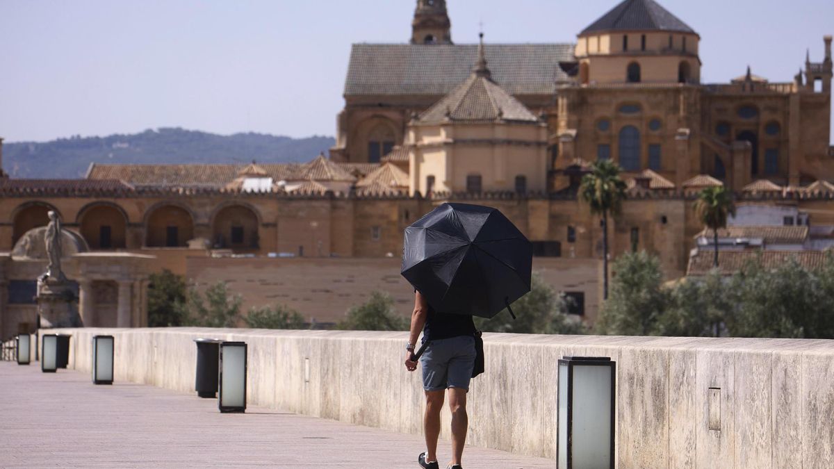
Diez comunidades siguen en aviso por calor y tormentas en una jornada con máximas de hasta 40 grados Andalucía, Madrid, Aragón, Navarra, Baleares y otras comunidades seguirán bajo aviso por altas temperaturasGuía para no arruinar tu eclipse: 15 errores que evitar al organizar el viaje y elegir desde dónde verlo El calor y las tormentas volverán a coincidir hoy lunes en buena parte de España. La Agencia Estatal de Meteorología (Aemet) mantiene el aviso en diez comunidades autónomas por altas temperaturas o por el riesgo de lluvias y tormentas que podrán ser fuertes e incluso localmente muy fuertes, acompañadas de granizo y rachas intensas de viento. Mientras tanto, los termómetros seguirán alcanzando valores propios de una intensa ola de calor en amplias zonas del sur y del nordeste peninsular. Las tormentas se concentrarán durante la tarde en la Comunidad Valenciana, el sur del sistema Ibérico, el sudeste peninsular y Navarra, donde la Aemet no descarta que puedan alcanzar intensidad muy fuerte de forma puntual. También existe probabilidad, aunque menor, de que estos episodios afecten al Pirineo oscense y zonas cercanas. Además de las tormentas, el calor seguirá siendo protagonista. Permanecerán bajo aviso por altas temperaturas Andalucía, Aragón, Baleares, Castilla-La Mancha, Catalunya, Comunidad de Madrid y Navarra. Tormentas de tarde y calor persistente El día comenzará con tiempo estable y cielos poco nubosos o despejados en la mayor parte del país. Solo Galicia, el área cantábrica, el alto Ebro y algunos tramos del litoral mediterráneo amanecerán con abundante nubosidad, aunque la previsión apunta a que el cielo se irá despejando conforme avance el día. Durante la tarde crecerán las nubes en el tercio oriental y en las montañas del norte, provocando chubascos y tormentas que podrán ser fuertes o muy fuertes en algunos puntos. De hecho, la Aemet advierte de que estos episodios podrán ir acompañados de granizo y rachas muy fuertes de viento, especialmente en zonas de Aragón, Castilla-La Mancha, Catalunya, la Región de Murcia, Navarra, La Rioja y la Comunitat Valenciana, que tendrán activas alertas por lluvias y tormentas. Las temperaturas máximas descenderán en parte de la mitad este, mientras que subirán ligeramente en el extremo noroeste y en el entorno de Alborán. Aun así, el calor seguirá siendo muy intenso, con más de 35 grados en amplias zonas de la mitad sur, del cuadrante nordeste, Baleares y algunos puntos de la meseta Norte. En el valle del Guadalquivir los termómetros podrán volver a superar los 40 grados. Entre las capitales de provincia destacan los 39 grados previstos en Córdoba, mientras que Albacete, Ciudad Real, Girona, Granada, Jaén, Palma, Toledo y Zaragoza alcanzarán los 38 grados. En Madrid también continuará el ambiente muy cálido, con una máxima prevista de 36 grados. Las temperaturas nocturnas tampoco darán un respiro. Continuarán las noches tropicales, con mínimas que no bajarán de los 20 grados en amplias zonas del sureste peninsular y en los archipiélagos. En algunos puntos del litoral mediterráneo los termómetros permanecerán incluso por encima de los 25 grados, dificultando el descanso como en las noches anteriores. En cuanto al viento, el alisio seguirá soplando con fuerza en Canarias, donde se esperan intervalos fuertes y probables rachas muy fuertes en las zonas más expuestas. En el resto del país predominarán los vientos flojos, aunque tenderán a intensificarse durante la tarde, coincidiendo con el desarrollo de las tormentas, con componente oeste en la vertiente atlántica, norte en la cantábrica y sur y este en la fachada mediterránea.
eldiario.es · about 2 months ago
Forsinkelser og innstillinger på Gardemobanen En feil på en sporveksler fører til innstillinger og forsinkelser i togtrafikken rundt Oslo mandag morgen.
aftenposten · about 2 months ago
Fifth heatwave approaching: Temperatures up to 35°C on Thursday Just days after the fourth regional heatwave in the Netherlands came to a
nltimes.nl · about 2 months ago

La chaleur joue les prolongations en Belgique : jusquà 30°C lundi avant une semaine sous surveillance Après un week-end marqué par des températures élevées, le début de semaine ne marquera pas de véritable rupture. Certaines régions profiteront toutefois dun ciel plus nuageux. ...
la libre · about 2 months ago

La Belgique nest pas armée face aux canicules : 95 des maisons de repos et des hôpitaux doivent être rénovés dici 2050 Les épisodes de chaleur extrême représentent un risque particulier pour les personnes âgées et fragiles. Or, avec le vieillissement de la population belge, les établissements qui les accueillent seront de plus en plus sollicités dans les prochaines décennies. ...
la libre · about 2 months ago
Leben und Arbeiten bei über 30 Grad: Heißer Scheiß Andauernde Hitze trifft viele Menschen hart: auf der Straße, zu Hause, im Job. Ein paar erzählen, wie sie durchhalten, wer ihnen hilft und was sich ändern müsste. mehr...
taz.de · about 2 months ago
Monday stays hot at 39C, with chance of mountain shower Monday will be mainly clear and hot, with temperatures reaching 39C inland, although a brief isolated shower cannot be ruled out over the mountains during the afternoon. Seasonal low pressure is affecting the region. Localised increased cloud is expected during the afternoon, mainly over higher ground, where it may bring a short isolated shower. Winds […]
cyprus mail · about 2 months ago
Anhaltendes Niedrigwasser: Binnenschiffer warnen vor einer Zweiteilung des Rheins An Deutschlands Flüssen herrscht wegen der Hitze derzeit vielerorts Niedrigwasser. Nun schlagen auch die Binnenschiffer Alarm.
tagesspiegel · about 2 months ago
Deutsche Binnenschiffer fürchten wegen Dürre um die Rhein-Route Der für die Schifffahrt wichtiger Pegel Kaub ist im Laufe der Woche wohl nur noch einstellig. Die Schiffsroute könnte damit zweigeteilt werden
der standard · about 2 months ago
Monday will be warm with afternoon rains in Latvia Forecasts suggest that warm weather is expected in Latvia on Monday.
lsm latvia · about 2 months ago

Niedrigwasser droht Rhein in zwei Teile zu spalten Der Rhein droht für die Schifffahrt zweigeteilt zu werden: Sinkende Pegelstände bei Kaub könnten den Güterverkehr massiv einschränken. Vier Bundesländer lockern das Sonntagsfahrverbot für Lkw, um Engpässe abzufedern.
welt.de · about 2 months ago
German industry: Lack of rain threatens Rhine shipping Low water levels in the Rhine risk stopping freight transport on a central stretch this week, effectively dividing the waterway in two, according to the German inland shipping association BDB. Due to a lack of rainfall, water levels at the Kaub measuring station are expected to fall below ten centimeters. At such low levels, commercial […]
cphpost · about 2 months ago
Pondelok bude horúci Do našej oblasti bude po zadnej strane tlakovej výše, ktorej stred sa presunie zo západnej Ukrajiny nad západné Rusko, prúdiť od juhozápadu veľmi teplý vzduch. Zároveň postúpi od západu nad stredné Poľsko, Česko a Rakúsko studený front spojený s tlakovou nížou, ktorej stred sa presunie z Nórskeho mora nad severnú Škandináviu.
aktuality.sk · about 2 months ago
„Ideal, wenn danach diskutiert wird Nach der Sommerpause warten große Baustellen auf die Politik: Die Wirtschaft stagniert, der Sparkurs ist spürbar, aktuell verschärfen Hitzewellen und Trockenheit die Lage. Welche Antworten sie darauf haben, bespricht Simone Stribl ab Montag wöchentlich mit den fünf Parteichefinnen und Parteichefs in den „Sommergesprächen. Für die Innenpolitikjournalistin, unter anderem bekannt aus „ZIB Talk und Früh-ZIB, sind es nach 2020 die zweiten „Sommergespräche. Heuer sollen – anders als in Wahljahren – vor allem Inhalte statt Parteitaktik im Mittelpunkt stehen.
orf.at · about 2 months ago
Vijfde hittegolf op komst, maar vandaag en morgen nog wat koeler We krijgen een tijdelijke pauze van de hitte: vandaag drijft meer bewolking over Nederland en ook morgen wordt het minder warm. Vanaf woensdag wordt het zonnig en tropisch heet.
rtl nieuws · about 2 months ago
Der Alpkäse schwitzt – Hitze auf 1700 Metern: Wie viel Technik verträgt der Alpkäse? Die Hitze stört die Reifung von Alpkäse. Viele Käsekeller genügen den Anforderungen nicht mehr und müssen nachhelfen.
srf.ch · about 2 months ago
Cyklotrasa na bývalé železniční trati mezi Loktem a Horním Slavkovem se letos prodlouží o 1,5 kilometru Práce na cyklotrase na bývalé železniční trati mezi Loktem a Horním Slavkovem pokračují mezi bývalým nádražím v Horním Slavkově a vlakovou zastávkou v Kounicích. Pracovníci odstraňují náletové dřeviny a upravují povrch pro pěší a cyklisty. Správa železnic chce část nákladů ušetřit. Zároveň při stavbě Správa železnic zaškoluje strojníky na nových strojích.
irozhlas.cz · about 2 months ago
Herbst im Sommer: Was die anhaltende Trockenheit mit den Bäumen macht Nach Jahren der Trockenheit kämpfen viele Bäume in Deutschland mit Hitze und Dürre. Was das für Wälder und Städte bedeutet – und wie es weitergehen könnte.
tagesspiegel · about 2 months ago
Niedrigwasser: Binnenschifffahrt warnt vor Zweiteilung des Rheins Der Pegel in der wichtigen Messtation Kaub dürfte erstmals auf einen einstelligen Wert sinken. Ab Mitte der Woche könnte der Fluss nicht mehr durchgängig befahrbar sein.
die zeit · about 2 months ago

„Nicht mehr durchgängig befahrbar – Zweiteilung des Rheins befürchtet Im Laufe der Woche wird an einem entscheidenden Punkt des Rheins ein besonders niedriger Pegelstand erwartet. Güter- und Ausflugsschiffe können dort dann keine Fahrten mehr durchführen, warnt ein Verband. Der Rhein werde damit im Prinzip zweigeteilt.
welt.de · about 2 months ago
Canicules et sécheresse : le jour sans fin des agriculteurs Cultivateurs et éleveurs sont à bout de souffle. Cette fois, les pansements provisoires pour répondre aux crises ne suffiront plus. Cest tout un modèle de fonctionnement, dexistence, qui doit être profondément repensé.
liberation · about 2 months ago
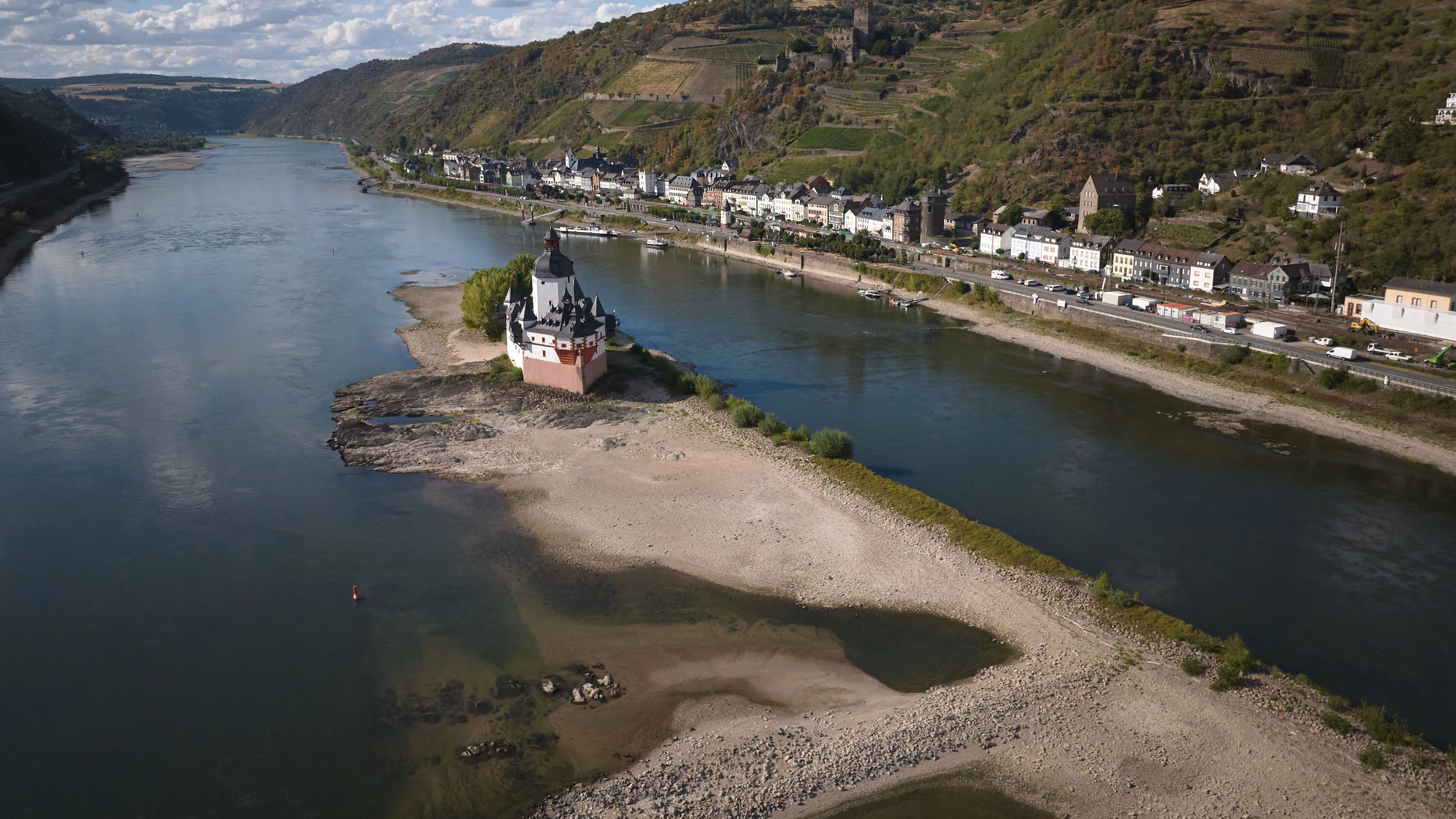
Schifffahrt in der Krise: Ausbleibender Regen könnte Rhein teilen Der Rhein könnte in Kürze nicht mehr durchgängig befahrbar sein. Für die neue Woche wird erstmals ein einstelliger Pegelstand prognostiziert. So würden für Güter- und Personentransport zwei getrennte Strecken entstehen.
faz · about 2 months ago
Foundation damage reports jump to 36-40 a week amid Dutch drought Ongoing drought is driving a sharp rise in foundation damage and sinking reports from Dutch homeowner
nltimes.nl · about 2 months ago